This is an archive of the old MediaWiki-based ImageJ wiki. The current website can be found at imagej.net.
File:MorphoLibJ-geodesic-distance-example.png
Size of this preview: 800 × 413 pixels. Other resolution: 320 × 165 pixels.
Original file (1,413 × 730 pixels, file size: 297 KB, MIME type: image/png)
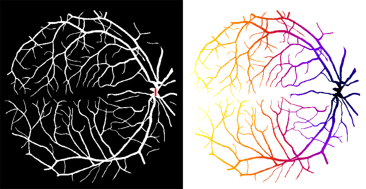
Computation of the geodesic distance map on a binary image from the DRIVE database (Staal et al., 2004). Left: original image with marker superimposed in red. Right: result of geodesic distance map, hot colors correspond to large distances, cold colors correspond to small distances.
File history
Click on a date/time to view the file as it appeared at that time.
| Date/Time | Thumbnail | Dimensions | User | Comment | |
|---|---|---|---|---|---|
| current | 10:13, 25 April 2016 | | 1,413 × 730 (297 KB) | Iarganda (talk | contribs) | Computation of the geodesic distance map on a binary image from the DRIVE database (Staal et al., 2004). Left: original image with marker superimposed in red. Right: result of geodesic distance map, hot colors correspond to large distances, cold colors... |
- You cannot overwrite this file.
File usage
The following page links to this file: